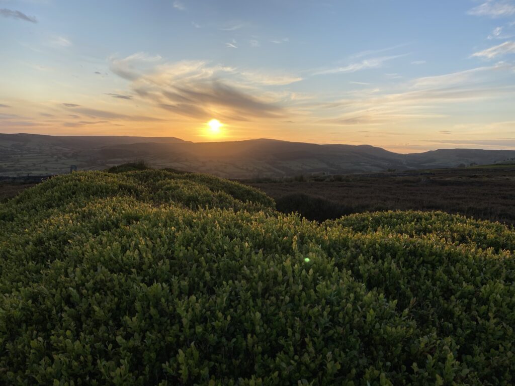
The solstice seems like an appropriate time to visit somewhere which is chock full of ancient tombs and strange stone carvings, which is one of the reasons why Urra Moor is so special, and is my favourite walk in the entire country. You’d be forgiven for never having heard of it, which is odd when you realise it’s the highest point of the North York Moors (Despite popular belief Roseberry Topping is not the highest coming in at 320m). But what it lacks in popularity it more than makes up for in its unique ancient landscape, with a huge number of ancient barrow graves, cairns, and rock carvings that seem almost as old as the hill itself. With one steep incline followed by an expansive plateau, it’s perfect for someone new to hiking or someone looking to spend a good few hours on some moderate endurance training.
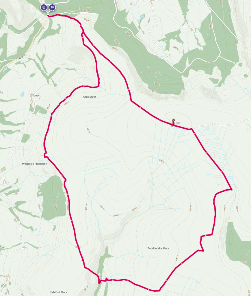
We’ll start off with the stats. Sitting at 454m, Urra (the name means “Dirty hill” and comes from old Norse. It shares it’s root with the English word whore!) might be the biggest peak around, but it’s not exactly in competition with the Lake District, nevermind the Highlands. For my 14km loop you’re looking at ascending a total of 430m, almost as high as the hill itself. The most popular place to start is from the main car park down at Clay Bank, although it is possible to start from Ingleby Greenhow and ascend either through the plantation on the western side, or up the infamous Ingleby Incline. There’s plenty of ways to change up this loop depending on your fitness level or the weather, and if you’re just looking to tag the summit and head back, it’s around 5km in total. It’s worth noting that Clay Bank car parks can get a little busy on bank holidays or good weekends, so try and get there early. Out of season you’ll rarely see more than 1-2 other people, and if you’re mad enough to go at 5:30 on a weekday like me, you’ll be on your own.
Starting from Clay Bank, you’ll begin to ascend via the Cleveland Way, with Greenhow plantation over the wall to the north and Urra farm tucked away past a small wood to the south. This is the hard bit, with a lot of steep steps that will lead you to the top of Carr Ridge, with a total of c130m to the top. It might be tough but on clear days the view is worth it, with excellent visibility you can see right across the Tees Valley and into County Durham, with Roseberry Topping being the most distinctive landmark on the skyline. In winter these steps can get a little treacherous, and in summer the field is often home to some very protective mother cows!
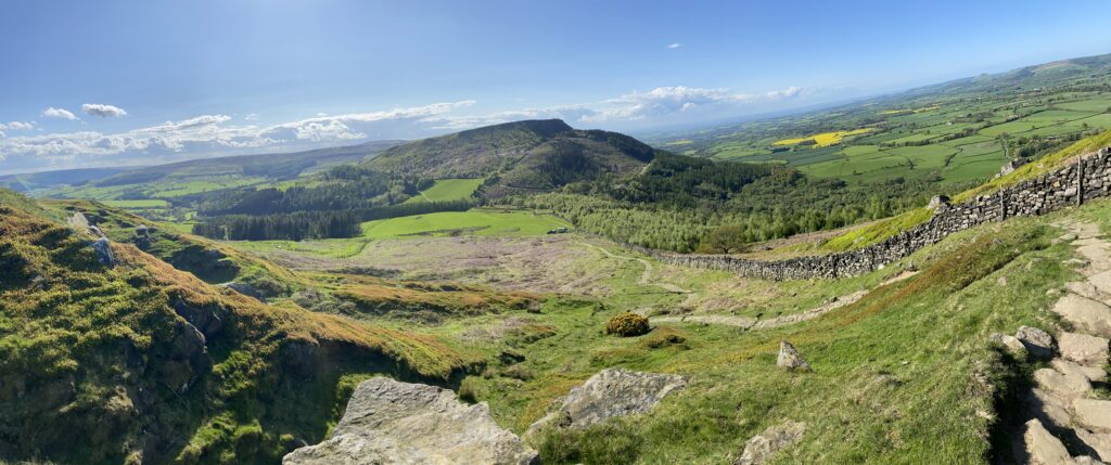
Carr Ridge is approximately 2.6km away from the summit, and after this steep ascent you’ll be pleased to see a gentle incline taking you up another 80m. You’ll have great views of both Bilsdale to the right of you, and Ingleby Greenhow to the left. Try not to step on the grouse if your eyes aren’t on the trail, they’re almost as ubiquitous as the sheep on Carr Ridge. This is the first time you’ll see one of the ancient relics for which Urra is famous for. Approximately halfway through, there is an ancient Bronze Age cairn on the right hand side. No, not the biggest one, which is a modern replica made by other hikers, but the one nearby that’s more a jumble of rocks half covered by heather. Urra Moor seems to have been sacred to generations of people in the area, who left many graves and monuments but otherwise nothing else. These almost otherworldly artifacts help give the moor its unique appeal.
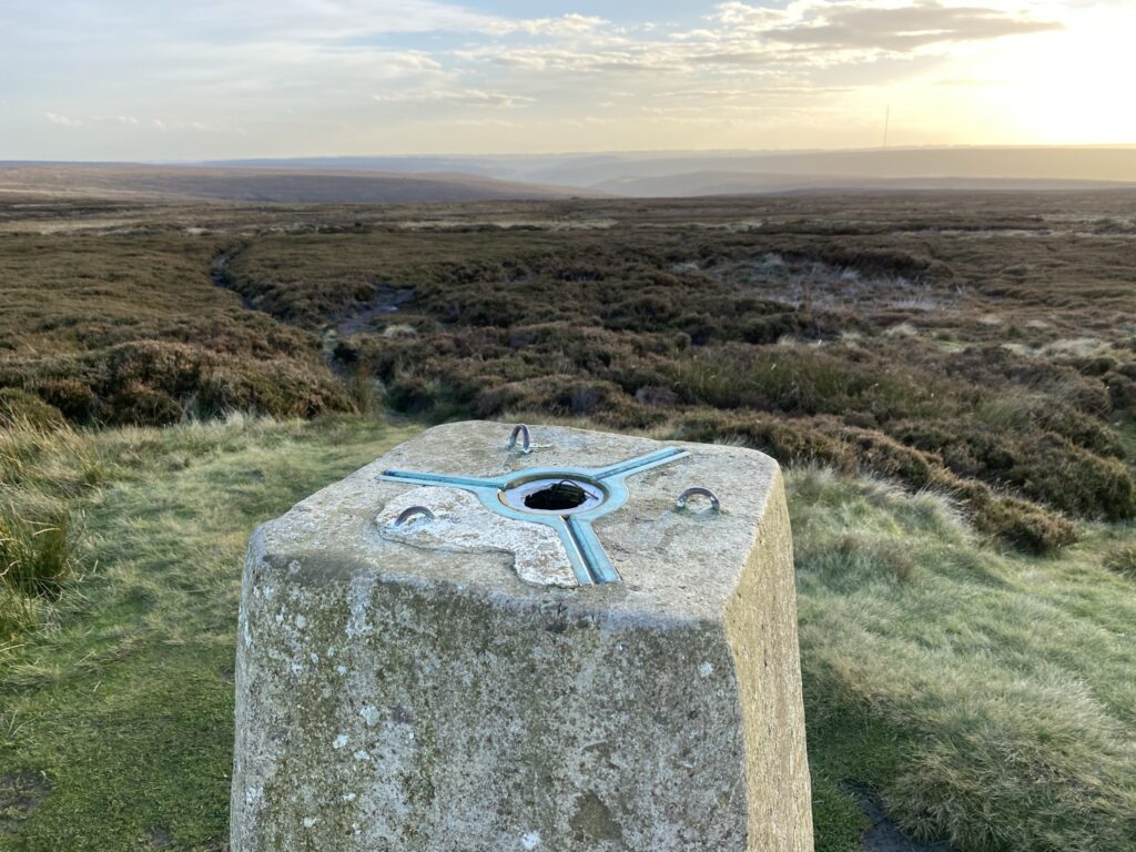
Round Hill, the summit, is now within reach as you bend to the east. The track here is very large, kept that way as a firebreak to prevent a repeat of some disatrous fires in the ‘50s and ‘60s. This is especially important as the to the south the expansive moor plays a special role as a haven for all sorts of endangered or otherwise rare wildlife. Depending on the season, it’s likely by now you’ve heard or even seen Urra’s noisiest resident, the Curlew. These birds are sadly on the red list, but the blanket bog style conditions up here make it their version of heaven, and many nest on the hill each year, along with Lapwings and Golden Plovers. Now as summits go, it might not be the most dramatic in prominence, but how many other summits have a barrow grave right beside them? The distinctive shapes to the west and east of the trig point mark some of the oldest graves in the northern half of the UK, made in the Bronze Age. It’s now time to congratulate yourself as you’ve officially reached not only the highest point in the North York Moors, but the highest point outside of the Pennines for a great distance!
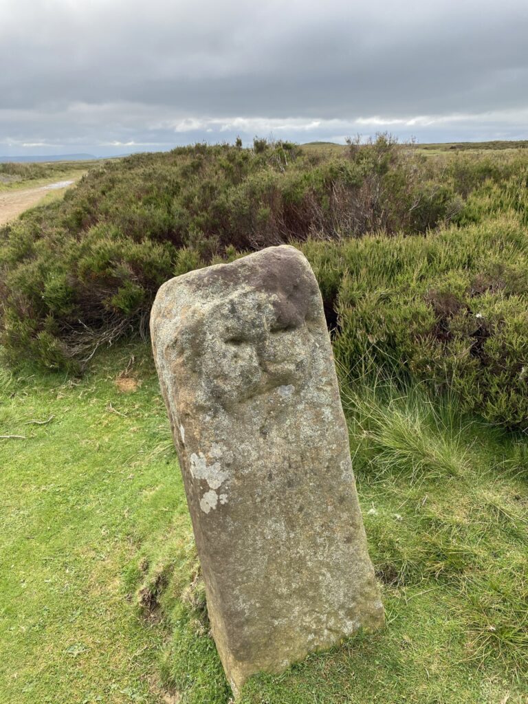
As you approached the summit you may have noticed a stone marker beside the path. This is an ancient marker, placed by local people in the Early Middle Ages. The side you first came to reads “This way Kir” indicating that Kirkbymoorside is to the east, with the reverse reading “This way Stoxla” depicting the way to Stokesley. Or at least that’s according to Steve Estill in his book “Stones and Crosses of the North York Moors” which is an interesting read if you’re into that sort of thing. Personally I’m not sure that’s what the markings actually mean, as I only got a C in my Anglo-Norse rock reading GCSE. The next stone on your travels is the most famous, the enigmatic face stone. Estill claims it is a Celtic gravemarker but otherwise has nothing else to say which is unusual given the amount of interest it seems to have generated. It first appears to us in the papers of the Duncombe Estate during the 1640s, during a division of the heathland. The sparse population of Cleveland means a there’s huge gaps in our knowledge of the area, and therefore we will never know the true origin of the face stone, so speculate to your hearts content. Perhaps it depicted a Bronze Age spirit or deity that inhabited the surrounding hills and as is often the case, the best mysteries are sometimes ones that remain unsolved. In any case, when you’re alone up here with just the setting sun and some Curlews for company, you start to get a sense of how those ancient people must have felt in such a sacred place.
It’s worth noting the semi-seasonal lakes and pools dotted around the summit. Urra is favoured by amphibians even as they decline elsewhere, and on a wet spring morning you’ll find this and other pools like it absolutely full of tadpoles or eggs. Following the distractions of mini megaliths and frogs, we now turn right at the first path after the summit and head south. For the next 0.5km or so it’s a simple track, but you’ll soon see the shape of the largest rock on Urra, the so called Badger Stone. Unlike the previous few examples, this one is entirely natural. Long before our ancestors came to Britain, the last great ice sheet smashed its way across northern England, dragging up all sorts of debris as it went. As the mercury rose and Britain became slowly hospitable, the sheets shrank and retreated to higher ground, leaving a scarred landscape in their wake. They also dropped anything they were carrying, which is where this collection of rocks come from. Their makeup is very different to the reddy ironstone that is common in the Cleveland hills, and it’s likely they originated in the Pennines and were deposited here by chance. Their prominence was noted in writing as early as the 1100s, and the name is a corruption of “bachelor”, likely in reference to their solitary position.
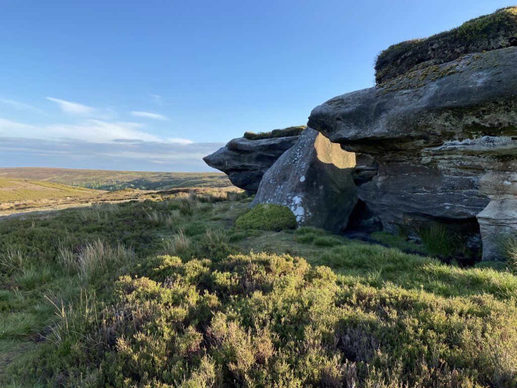
Carrying on past the stones, we ascend a small hill, surrounded by several overgrown cairns and with another barrow complex beside the path too. It bares repeating just how unique this landscape is, as it’s rare to have so many in one hike that they almost start to lose their uniqueness! The path we wish to take is to the right, just beside a large mound made by excavators. It’s very easy to miss this turn off (I have many a time!) and if you do you can simply turn right later on and the paths converge past some very ominous looking sheep huts. The area that has been excavated is another seasonal lake, and again a haven for amphibians depending on the local weather conditions. This section of the hike is around 3km long in total, and will see us descend c120m as we head toward Tripsdale Beck. This is your classic North York Moors landscape, with a lot of game, miles of heather, and stunning views to the south if the weather allows for it. The new and improved Bilsdale Tower acts as a beacon in the distance, and is pretty useful for reorientating yourself if you ever find yourself turned-around and unsure which way is which!
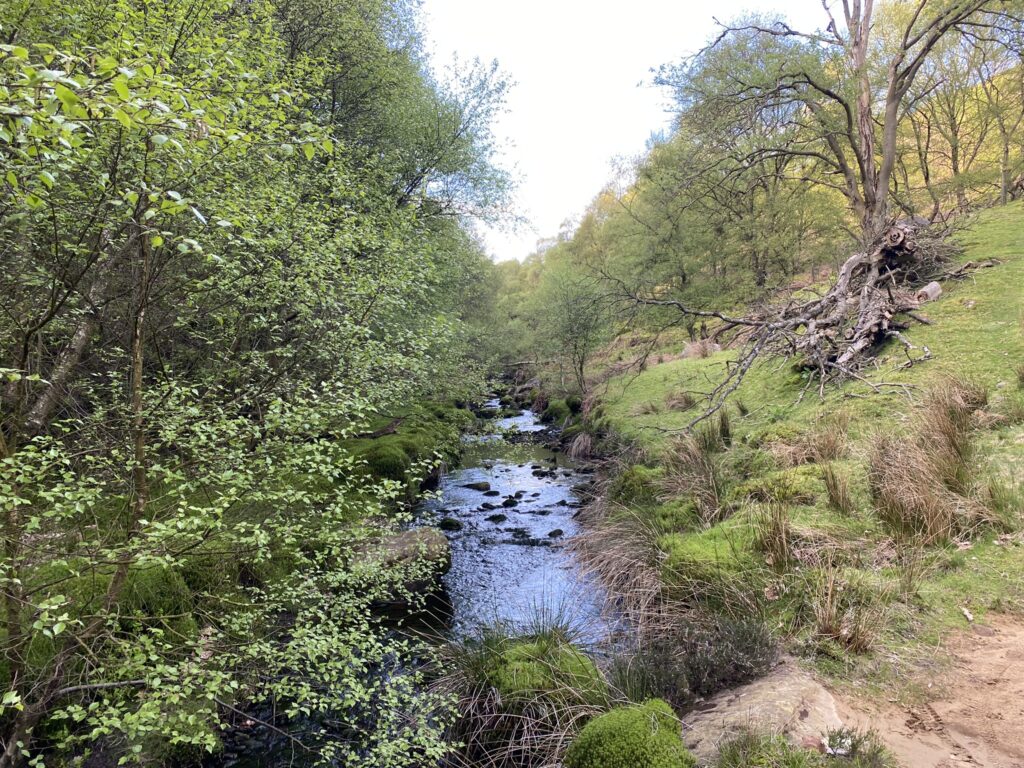
As we descend toward Tripsdale Beck, the landscape changes. In the middle of the relatively barren moorland sits a lush, green valley, almost seeming like an oasis. The shelter provided by the valley walls, and the constant water cascading down the rocks has led to a small strip of woodland, largely made up of deciduous trees that are indigenous to the British Isles. In summer this is a riot of colour, and even in the dead of winter you’ll still hear a whole host of birds chattering away. This little pocket of peace and quiet is one of my favourite parts of the whole trip. Deer and pheasant are fairly common here, with both being absent from the rest of the much more exposed moor.
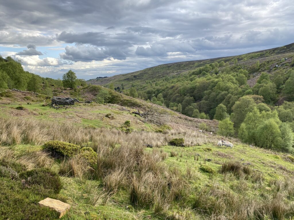
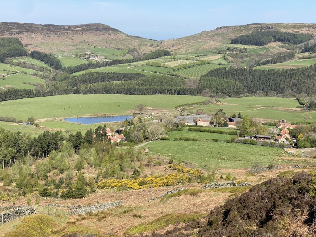
Ascending up the steep bank, you’ll emerge on what is known as Nab End Moor. Depending on the time of day and year, this will give an amazing view over Bilsdale, and onto the western Cleveland hills beyond. You’ve also got all the strenuous bits of the hike out of the way, and as you continue on north, it’s approximately 5.2km to get back to the top of Carr Ridge. Along this long relatively straight and flat path, you’ll see the East Bank Plantation below you to the west. This is a conifer plantation, but has a nice mix of broad leafed trees as well, and a treeless zig zag shaped pattern through the forest will take you to the valley floor and back. Well worth a walk through if woods are more your thing, and keep your eyes peeled for the many families of roe deer that call it their home. On the other side to your east, is Broad Ings. Ings is an Anglo-Norse word for a type of wetland, and these ings are home to a large concentration of Curlews and Lapwings. On one of my most recent trips I was treated to a lengthy display of what I thought were two Lapwings in courtship. The sight of a bird of prey suddenly taking off out of the undergrowth carrying a grouse chick made it very clear this was more of a panicked frenzy…
The final section before Carr Ridge will see you curve round the ridge of the hill, and into what is often a very boggy section in winter or if it’s recently rained. There are some wooden beams over the worst bits, but they’re old so expect to get very wet and muddy! On the most prominent corner, just before you must leap over Cowkill Well, there sits a large boulder just on the edge of the escarpment. Named the Cheshire Stone for reasons that elude me, it is a natural stone, but arrowheads and other flint materials that have been made by the earliest Britons have been recovered there, meaning it likely held some significance to ancient people. Or maybe those who made those tools simply appreciated the beautiful view over the valley it provides! Everytime I see this I’m reminded of my brief flirt with knapping during the madness of the third lockdown. I keep meaning to pick it back up, with all the best intention in the world to do so.
By now you’re almost at the end, and it’s only a short rise to the top of Carr Ridge where you’ll join the path leading to Round Hill beneath the Cleveland Way signpost. At sunset this area is beautiful, bathed in an orange glow with the eastern hills casting long shadows over the landscape. Head back down through the gate, and take care on the steep steps as they can be lethal with a cover of ice. We’re now back at Clay Bank, having covered a total of c14km, ascended 430m, and saw more megaliths, barrows, and cairns than you can count. Personally I like to try and do Urra every couple of months at least. Whilst there’s other taller and more exciting ones to do out there, something about the landscape up here means it always has a special place in my heart.

The route can be found here. I highly recommend purchasing the OS maps subscription package if you go hiking even moderately often, as the offline maps are invaluable when out of signal.
My ratings
| Aspect | Rating |
| Difficulty |    |
| Technical |  |
| Views |    |
| Nature |     |
| History |     |
Leave a Reply