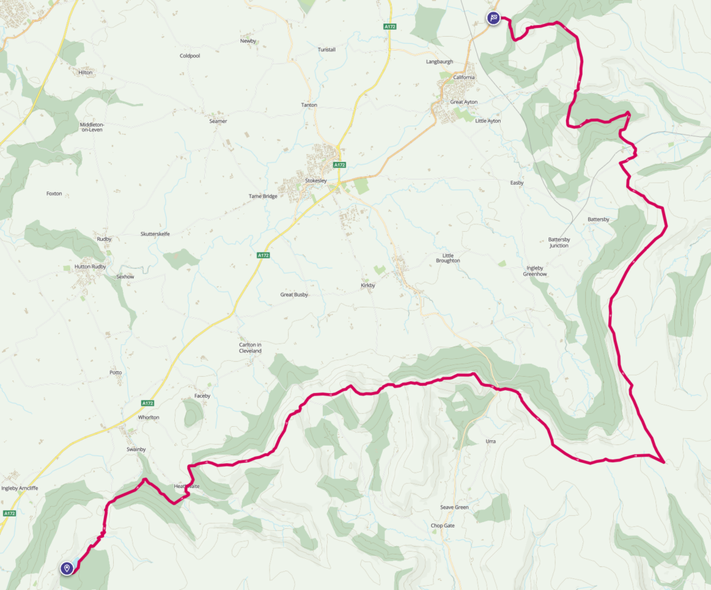
As I came out of the first lockdown, having not left my parents neighborhood nor taken a day off since March, I went for a walk from Cod Beck reservoir, and just “forgot” to stop, ending up collapsing in an exhausted but happy heap near Kildale, having walked about 32km in total. I wasn’t fit at all back then, and I had the desire to complete the Cleveland Way from Osmotherly to Roseberry Topping. In the deep snow of January 2021 I got to Urra before having to call it off, and a few months later managed to do it the reverse way, totaling 38km. However, 38 is not a nice number. I needed to find a way to eek out the trail long enough to hit that nice, round 40. And on Saturday 15th July that’s what I set out to do.
I started out at Cod Beck reservoir. Usually this is one of the most popular places in the western moors, but at 6:30am on a Saturday there were very few people about. The weather was pleasant, but there were definitely storm clouds on the horizon so I had to get a move on. I walked along the southern shore and then down Sheepwash (which brought back memories of catching fish as a kid!) before following the road north and rejoining the Cleveland Way at Near Moor Woods. These woods are one of my favourite places in the local area, and it was the first place I’d ever seen woodpeckers flying around in relatively large numbers. Beside from a descent down a bank in the middle, this whole part of the walk is fairly flat and acts as a nice warm-up to the hills ahead. The woods here are deciduous, but on the hill above to the right is the conifer plantation which changes often. Areas that have been deforested fairly recently often attract deer who look for new shoots, so I always try and see if I can spot one and use this as an excuse not to pay for an eyetest at Boots… The Cleveland Way takes a leftward turn and down the hill, crossing Scugdale Beck (a very North Yorkshire name!) over a picturesque ford and bridge, before going up the road to the Hollin Hill farmstead.
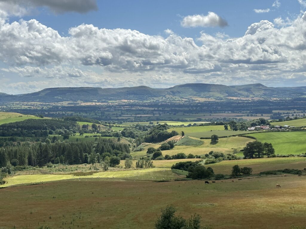
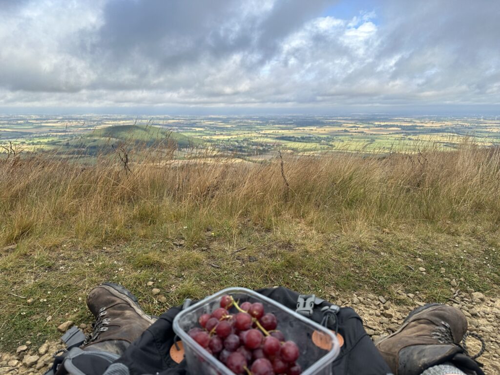
The first climb starts here. From the Farm up to the top of the first hill, Live Moor (315m), it is about 150m. The climb is up some steep steps through the woods, and with how warmed up I was from the several km already, passed extremely quickly. Up on the top here there’s cairns, barrows, and ancient field systems galore so I was in my element. Gold Hill (320m) is next, but with this part of the Cleveland Hills it can be a bit tricky to even notice these different hills as distinct peaks as they’re close together and very similar in height. The walk here now goes upward again, up Faceby and Carlton Bank to Carlton Moor (408m). Halfway through this stretch is a disused WW2 airfield. It can be extremely hard to see, but the differences in vegetation do show where the airstrip used to be (in my experience it’s much easier during winter when there’s been snowfall). I decided to sit and take the first break of the trip here, enjoying the good weather whilst it lasted. Apart from Urra, this part of the hike is my favourite part of the Cleveland Hills. I once attempted to do this whole 40km treck in winter once (a doomed but valiant effort), and had the privilege to walk through knee deep, untouched snow on here. The contrast between the winter sunrise, the fresh snow, and the browns of the heathland was otherworldly. With the cairns and barrows it truly felt like an Ice Age landscape.
Descending down the other side of Carlton Bank, the next place on the hike is Lordstones. Here a small half circle of standing stones look out over the Tees Valley, accompanied by another single standing stone nearby. Like most of the ancient monuments here, these date from a time long before the Celts that they’re usually associated with, and mostly come from the Bronze Age. The woods nearby are well worth a walk through, and there’s many interconnecting paths to get lost in. The density of the woodland means human disturbance is limited, and there’s a myriad of pools and streams in here that are otherwise rare on the steep faces of the hills. This time I didn’t venture into the woods, prefering to simply stick to the Cleveland Way, but I was there in there earlier in the week and managed to hear a Marsh Tit, which is sadly a rare species. Given the height it was very unexpected.
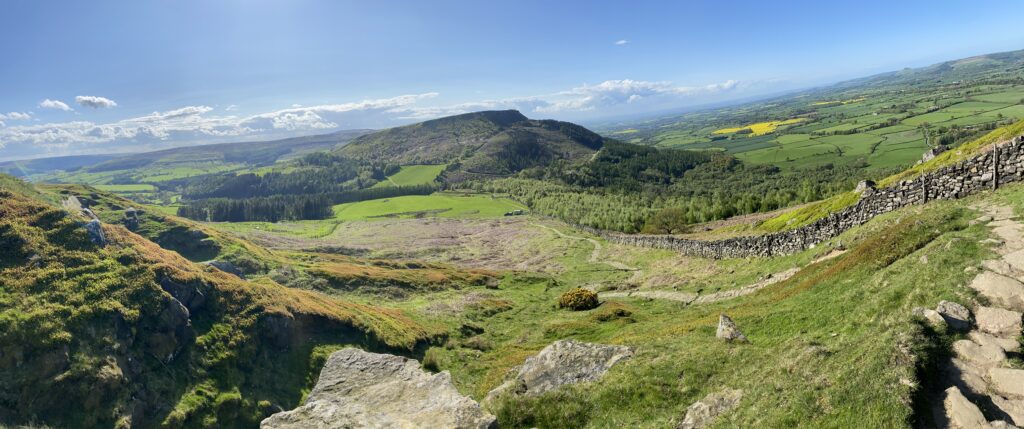
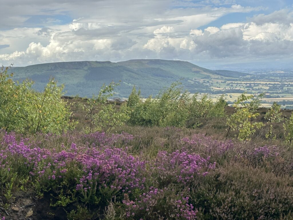
Climbing another 100m I arrived at the Cringle Moor viewpoint, where a very large stone throne sits, affording the occupant amazing views right across Teesside, and on clear days straight through into County Durham. From there it was only another 30m to clibm to reach the top of Cringle Moor (432m), which marks the 2nd highest point of both this hike and the Cleveland Hills. Cringle Moor is definitely the most impressive looking of the hills aside from Roseberry Topping, and from a distance looks the largest. Fitting for such an impressive hill, it also boasts one of the largest barrows I have ever seen. At 25m wide, Drake Howe (Howe is a Norse word for mound) clearly demonstrates the classic round outer wall of a barrow, and the inner raised area where the bodies would have been placed. I wonder how long these barrows lasted before their ceilings caved in and they became ruins. The other, more recent and dramatic name for the barrow is Odin’s Grave, which is likely due to the belief that this was built by the Vikings during their rule of Northumbria. After his death during Ragnarok, the King of the Gods decided that the one place he’d love to spend eternity overlooking is Teesside. UTB.
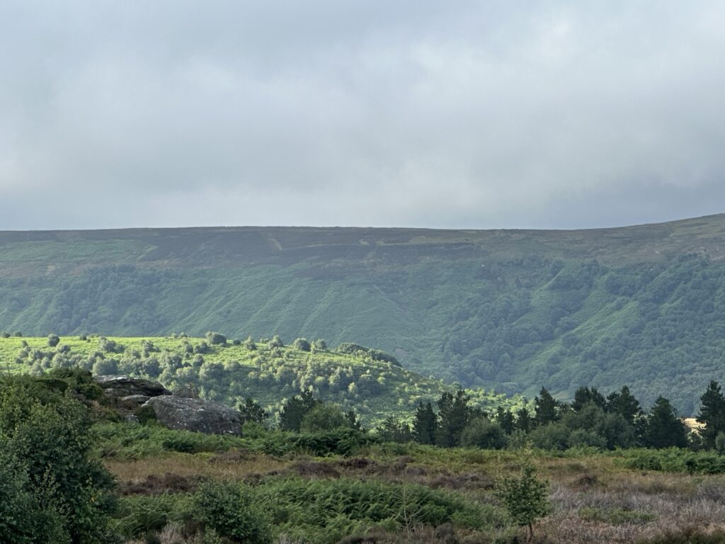
The weather had started to get worse by now, and the winds were up to 40km. It was another 100m down and then up again to get to the next hill, Cold Moor (401m). The steep ups in these hills are great for getting your step count up, but going down is always a pain as it’s slow in wet conditions. Cold Moor itself is probably the least interesting hill in Cleveland. It does have some barrows and cairns but they’re much further south off the beaten track. I made my way across quickly, and onto Hasty Bank (397m). Hasty Bank is home to the Wainstones, which are huge boulders strewn around the west side of the hill, arranged in such a way that they make a great climbing experience. Unlike a lot of the other notable rocks on this walk, these are completely natural, although some do bare cup and circle markings that are common Bronze Age art (along with a whole host of graffiti made over the last few hundred years!). The name comes from the old English word for cart, and may reference an old belief that they were dumped here from a wagon.
Up next was Urra, a place that I have extensively covered in the first entry of this blog. The Cleveland Way goes up Carr Ridge, on toward the summit, and then continuing east toward Blowworth Crossing. Given that I’ve covered it a lot I won’t write much here, other than to say I have never seen so many people on Urra as I did that day. I’d managed to make it this far with only encountering one other person, right at the start, so I suppose I shouldn’t complain like a miserable bastard.
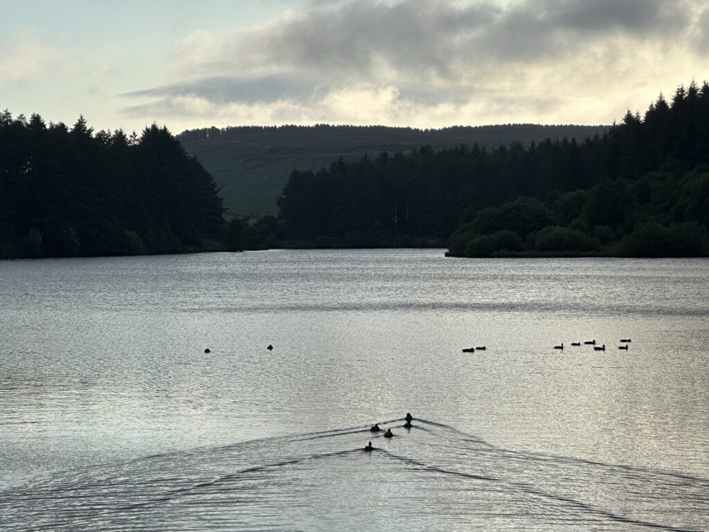
Almost every time I’ve walked the Cleveland Way, heading north from Urra/Blowworth the weather has turned bad. This time was no different, and I was hit by the first thunderstorm of the walk. It’s a long and rather barren stretch anyway, so being blasted by a big summer storm simply added to the fun. However, as this is England, it lasted about 10 minutes and was followed by glorious sunshine, which made the damp, green hills look absolutely stunning. This summer has been wet and sunny, and I don’t think I’ve seen the Cleveland Hills remain this green this deep into summer before which is fantastic. The pools that the amphibians rely on have also lasted longer this year, which is great news as many of them are sadly now red list species. The path here is fairly easy to follow, gently dropping down 200m or so over the course of the next 6km. The surrounding moorland is the classic, barren type, and is home to many Curlew and Lapwings. On the right is first the small valley of Baysdale, with an Abbey that looks more like a barrack block, or the home of Father Ted, than anything as regal as Fountains or Reivaulx. Finally the path joins a road which descends down Dark Dale, which seems to always have a bird of prey soaring over it each time I pass by.
The picturesque village of Kildale is up next. Just off the Cleveland Way there is a lovely Saxon style church, which I found after I got lost and missed the correct turn off during the summer 2020 attempt… The correct path actually goes into the Kildale Estate, and to the left turns off into Mill Bank Wood which has a beautiful series of waterfalls made by the River Leven as it makes its way to the Tees. Instead I kept going up the hill, past Bankside Farm and onto Coate Moor. As such as I’d reached this forest then storm number 2 broke, and I was pelted with hailstones which is fitting for an English summer of course. The weather was so bad in fact that I brought out my waterproof jacket which is definitely a rare occurrence, and trudged through the mud of Easby Moor (324m), where Captain Cook’s Monument is located. I’ve been walking and running here before work for many years, and the forest is full of deer and rare birds that you can spot if you go early enough when it’s quiet. Naturally the thunder and hailstone meant that this was not one of these times. By now my legs were really starting to hurt, and the climb up the steep steps to the top of Great Ayton Moor was not one of my best. However there were now only a couple of km separating me from a nice pint at the pub. Now that the storm had abated once again, I got some cracking shots of Roseberry Topping looking brilliant in the summer sun, set against all the trees and fields.
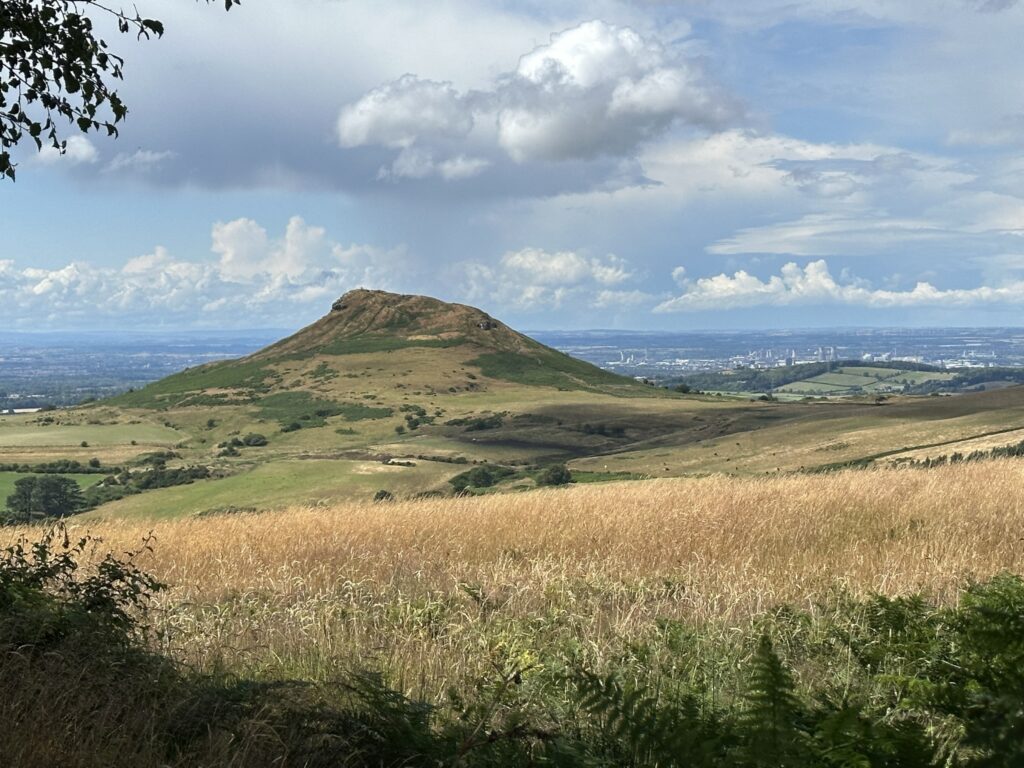
However, as I came down the 80m or so drop from Carlton Moor, I realised that my knee just wouldn’t be able to manage going down the steps on the other side of Roseberry Topping, so I have to admit that I just skirted around the edges through the ferns and woods. This was a nice excuse for me as I’m not a fan of Roseberry Topping on a weekend at all, given the crowds that it attracts. But I was done. As I limped down Roseberry Lane, finally hitting the 40km distance mark, all I could think about was a nice pub lunch. I decided to treat myself to a fantastic Lindasfarne Chicken with a pint of Roseberry Ale at the Kings Head Inn, which I believe was definitely well deserved!
In total this hike was 40m, with over 1.3km ascended, which makes it by far my longest one. The OS map of the route can be found here (I managed to stretch it to 40km by venturing off trail to look at things!).
| Aspect | Rating |
| Difficulty | |
| Technical |  |
| Views |  |
| Nature | 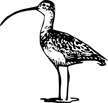 |
| History |  |
Leave a Reply